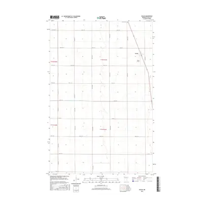
2016 Map of Euclid
USGS Topo · Published 2016About this map
The settlement of Euclid anchors this northern Minnesota landscape, situated along the diagonal rail corridor in Polk County. This map illustrates the highly organized agricultural grid of the Red River Valley, where gravel roads such as Co Hwy 18 and 320th Ave SW divide the terrain into precise sections. Evidence of local infrastructure is found in specialized features like the Shimpa Airstrip and the Prairie View Cem north of the main village. The hydrology of the area is defined by managed drainage systems, most notably County Ditch Number One Hundred Twenty-six, which cuts across the flat township lines. These features reflect a mid-20th-century landscape dedicated to large-scale farming and local transport connectivity.
Find a feature on this map
25 named features on this map. Tap any name to fly to it.
Don’t see what you’re looking for? This feature index may not catch every label — zoom into the map to look around manually.
Map Details
Editions of this 2016 Euclid Map
This is the sole edition of this map. No revisions or reprints were ever made.
Other maps of this area

1918 · Angus
USGS Topo · 1:62,500

1918 · Warren
USGS Topo · 1:62,500

1952 · Grand Forks
USGS Topo · 1:250,000

1952 · Thief River Falls
USGS Topo · 1:250,000

1953 · Crookston
USGS Topo · 1:62,500

1955 · Warren
USGS Topo · 1:62,500

1956 · Thief River Falls
USGS Topo · 1:250,000

1956 · Grand Forks
USGS Topo · 1:250,000

1957 · Thief River Falls
USGS Topo · 1:250,000
1961 · Angus SE
USGS Topo · 1:24,000