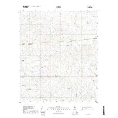
2018 Map of Eucutta
USGS Topo · Published 2018About this map
Eucutta sits at the heart of this landscape, where the rolling timberlands of Wayne and Clarke counties are defined by a dense network of watercourses and rural cemeteries. The area is dominated by the drainage systems of Beaverdam Cr and Eucutta Cr, which carve through the terrain beneath landmarks like Sugar Hill. This 2018 survey reveals a settlement pattern tied to long-standing family and community sites, evidenced by the numerous burial grounds scattered throughout the hills, including Evergreen Cem, Bethlehem Cem, and Sandhill Cem. The road network, including Shubuta Eucutta Rd and Springhill Church Rd, connects these remote points of local heritage, tracing the same ridges and valleys that have shaped life in this corner of Mississippi for generations.
Find a feature on this map
62 named features on this map. Tap any name to fly to it.
Don’t see what you’re looking for? This feature index may not catch every label — zoom into the map to look around manually.
Map Details
Editions of this 2018 Eucutta Map
This is the sole edition of this map. No revisions or reprints were ever made.
Other maps of this area

1953 · Hattiesburg
USGS Topo · 1:250,000

1958 · Hattiesburg
USGS Topo · 1:250,000

1963 · Heidelberg
USGS Topo · 1:24,000

1964 · Heidelberg SW
USGS Topo · 1:24,000

1964 · Eucutta
USGS Topo · 1:24,000

1964 · Myrick
USGS Topo · 1:24,000

1964 · Hale
USGS Topo · 1:24,000

1964 · De Soto
USGS Topo · 1:24,000

1964 · Waynesboro
USGS Topo · 1:24,000

1964 · Whistler
USGS Topo · 1:24,000