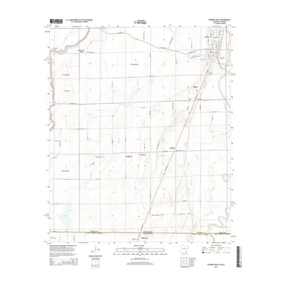
2014 Map of Eudora South
USGS Topo · Published 2014About this map
Eudora and the surrounding agricultural lowlands of the Mississippi Delta define this 2014 survey along the state line. The landscape is deeply carved by a network of waterways including the Boeuf River, Bayou Macon, and several smaller channels like Caney Bayou and Indian Bayou. This intricate drainage pattern historically dictated the placement of settlements and transport routes across the Arkansas-Louisiana border. Small communities and named locales such as Hanna, Wellford, and Ross Van Ness are scattered throughout the quadrangle, connected by rural roads like AR 8 Hwy W and AR 159 Hwy S. Local history and genealogy are preserved at sites like Mt Carmel Cem and Masons Cem, while Ward's Airport reflects the region's modernization. The map captures the transition between Chicot County and West Carroll Parish at a time when these rural hubs remained central to the local identity.
Find a feature on this map
89 named features on this map. Tap any name to fly to it.
Don’t see what you’re looking for? This feature index may not catch every label — zoom into the map to look around manually.
Map Details
Editions of this 2014 Eudora South Map
This is the sole edition of this map. No revisions or reprints were ever made.
Other maps of this area

1909 · Millikin
USGS Topo · 1:24,000

1909 · Ashton Bridge
USGS Topo · 1:24,000

1912 · Ashton Bridge
USGS Topo · 1:31,680

1935 · Oak Grove
USGS Topo · 1:62,500

1936 · Eudora
USGS Topo · 1:62,500

1939 · Readland
USGS Topo · 1:62,500

1939 · Mayersville
USGS Topo · 1:62,500

1953 · Greenwood
USGS Topo · 1:250,000

1955 · Jackson
USGS Topo · 1:250,000

1956 · Greenwood
USGS Topo · 1:250,000