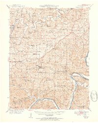
1951 Map of Eugene
USGS Topo · Published 1951About this map
The Chicago Rock Island and Pacific railroad tracks bisect the landscape between the Osage River and the northern hills of Cole Co and Miller Co during the mid-century. Small rural hubs like Eugene and Henley sit along the rail line, supported by a network of one-room schools and country churches such as Rush Chapel and Mount Union Ch. The topography is defined by the winding Moreau Creek and the deep cut of the Tavern Creek valley as it joins the Osage near St Elizabeth. Genealogists will find a wealth of family history in the numerous small burial grounds, including McCann Bridge Cem, Harbison Cem, and the Spring Garden Cem, which anchor the various farming communities scattered across the creek-fed ridges.
Find a feature on this map
86 named features on this map. Tap any name to fly to it.
Don’t see what you’re looking for? This feature index may not catch every label — zoom into the map to look around manually.
Map Details
Editions of this 1951 Eugene Map
2 editions found
Other maps of this area

1886 · Jefferson City
USGS Topo · 1:125,000

1888 · Versailles
USGS Topo · 1:125,000

1888 · Tuscumbia
USGS Topo · 1:125,000

1888 · Boonville
USGS Topo · 1:125,000

1893 · Versailles
USGS Topo · 1:125,000

1894 · Tuscumbia
USGS Topo · 1:125,000

1894 · Jefferson City
USGS Topo · 1:125,000

1904 · Eldon
USGS Topo · 1:62,500

1932 · Versailles No 4
USGS Topo · 1:48,000

1933 · Iberia
USGS Topo · 1:62,500