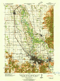
1940 Map of Eugene
USGS Topo · Published 1940About this map
Eugene and Springfield dominate the southern reach of this valley landscape, depicted here at a pivotal moment of mid-century infrastructure growth. The convergence of the Willamette River and McKenzie River defines the local geography, creating a network of waterways including Deadman Slough and Marshall Island. The area is characterized by a dense grid of rural schools, such as Santa Clara School, Norkenzie School, and Deadman School, reflecting the decentralized educational system of the era before widespread district consolidation.
Find a feature on this map
67 named features on this map. Tap any name to fly to it.
Don’t see what you’re looking for? This feature index may not catch every label — zoom into the map to look around manually.
Map Details
Editions of this 1940 Eugene Map
2 editions found

Other maps of this area

1909 · Harrisburg
USGS Topo · 1:31,680

1909 · Rowland
USGS Topo · 1:31,680

1909 · Elmira
USGS Topo · 1:62,500

1910 · Eugene
USGS Topo · 1:62,500

1911 · Monroe
USGS Topo · 1:31,680

1912 · Halsey
USGS Topo · 1:62,500

1921 · Brownsville
USGS Topo · 1:62,500

1921 · Cottage Grove
USGS Topo · 1:62,500

1922 · Monroe
USGS Topo · 1:62,500

1922 · Elmira
USGS Topo · 1:62,500