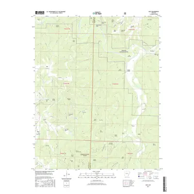
2017 Map of Eula
USGS Topo · Published 2017About this map
The Buffalo National River corridor dominates the northern half of this landscape, carving through steep terrain marked by prominent landmarks like Point Peter and The Narrows. This region on the border of Newton and Searcy Counties is characterized by isolated settlements and a dense network of cemeteries that serve as vital markers for family historians. Small communities such as Woolum, Flat, and Bass are connected by winding county roads that navigate a series of deep hollows, including Ed Clair Hollow and Puss Hollow. To the south, the Ozark National Forest encompasses high points like Barlow Christian Mtn and Iceledo Mtn, while the Ozark Highlands Trail provides a continuous path through the timber. The map also highlights numerous family-named burial sites like Hendrix Cem and Taylor Cem, alongside geological features such as John Reddell Bluff and Stack Rock.
Find a feature on this map
97 named features on this map. Tap any name to fly to it.
Don’t see what you’re looking for? This feature index may not catch every label — zoom into the map to look around manually.
Map Details
Editions of this 2017 Eula Map
This is the sole edition of this map. No revisions or reprints were ever made.
Other maps of this area

1892 · Marshall
USGS Topo · 1:125,000

1893 · Yellville
USGS Topo · 1:125,000

1894 · Marshall
USGS Topo · 1:125,000

1901 · Marshall
USGS Topo · 1:125,000

1903 · Yellville
USGS Topo · 1:125,000

1904 · Harrison
USGS Topo · 1:125,000

1905 · Harrison
USGS Topo · 1:125,000

1905 · Yellville
USGS Topo · 1:125,000

1929 · Yellville
USGS Topo · 1:125,000

1933 · Mt Judea
USGS Topo · 1:62,500