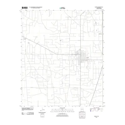
2010 Map of Eunice
USGS Topo · Published 2010About this map
Eunice serves as the primary hub of this high plains landscape, situated near the eastern edge of Lea County. The grid-like street pattern of the town is anchored by Texas Ave and 8th St, showing the concentrated residential and commercial footprint amidst a vast network of section roads and energy-related corridors. To the northeast, the settlement of Jones City appears as a distinct community node along the drainage of Monument Draw, while the Eunice Airport and the facility at Armstrong and Armstrong mark the outskirts. The terrain is characterized by the wide, level expanse of Hardy Flats, where the road system—including County Rd-22 and County Rd-33—facilitates movement across the oil-rich Permian Basin. This survey documents the intersection of specialized industry and local settlement during the early 21st century.
Find a feature on this map
18 named features on this map. Tap any name to fly to it.
Don’t see what you’re looking for? This feature index may not catch every label — zoom into the map to look around manually.
Map Details
Editions of this 2010 Eunice Map
This is the sole edition of this map. No revisions or reprints were ever made.
Other maps of this area

1954 · Hobbs
USGS Topo · 1:250,000

1958 · Hobbs
USGS Topo · 1:250,000

1963 · Oil Center
USGS Topo · 1:62,500

1963 · Monument
USGS Topo · 1:62,500

1969 · Hobbs SW
USGS Topo · 1:24,000

1969 · Eunice
USGS Topo · 1:24,000

1969 · Hobbs SE
USGS Topo · 1:24,000

1969 · Eunice NE
USGS Topo · 1:24,000

1969 · Eunice SE
USGS Topo · 1:24,000

1969 · Rattlesnake Canyon
USGS Topo · 1:24,000