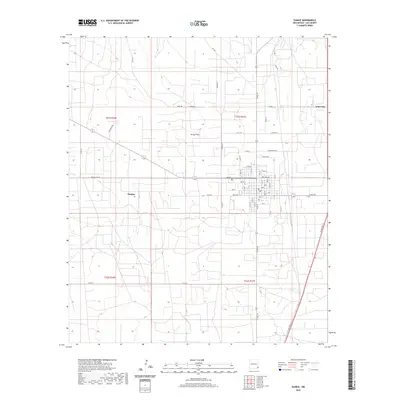
2020 Map of Eunice
USGS Topo · Published 2020About this map
Eunice and the nearby settlement of Jones City define this corner of the Permian Basin, where the high plains landscape is marked by a precise grid of oil-field roads and municipal streets. The town's expansion is evident in the development around Eunice Byp and the residential layout extending from Texas Ave to Ave D. Beyond the city center, the terrain levels out at Hardy Flats, a distinctive local landmark amidst the township and range survey lines of T21S and T22S. This 2020 layout preserves the modern industrial and transportation network of southeastern Lea County, including major connectors like Turner Rd and Co Rd 18, providing a clear record of the area's infrastructure and land use just south of the more densely developed oil centers.
Find a feature on this map
36 named features on this map. Tap any name to fly to it.
Don’t see what you’re looking for? This feature index may not catch every label — zoom into the map to look around manually.
Map Details
Editions of this 2020 Eunice Map
This is the sole edition of this map. No revisions or reprints were ever made.
Other maps of this area

1954 · Hobbs
USGS Topo · 1:250,000

1958 · Hobbs
USGS Topo · 1:250,000

1963 · Oil Center
USGS Topo · 1:62,500

1963 · Monument
USGS Topo · 1:62,500

1969 · Hobbs SW
USGS Topo · 1:24,000

1969 · Eunice
USGS Topo · 1:24,000

1969 · Hobbs SE
USGS Topo · 1:24,000

1969 · Eunice NE
USGS Topo · 1:24,000

1969 · Eunice SE
USGS Topo · 1:24,000

1969 · Rattlesnake Canyon
USGS Topo · 1:24,000