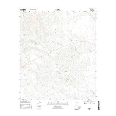
2016 Map of Eunice
USGS Topo · Published 2016About this map
Eunice and its surrounding countryside represent a landscape defined by an intricate network of waterways and private landholdings in eastern Texas. The area is heavily intersected by seasonal drainage and sloughs, most notably the wide expanse of Beaver Dam Marsh and the wandering paths of Busch Slough and Pecan Slough. While the settlement of Eunice itself serves as a central point, much of the terrain is dedicated to ranching and local aviation, evidenced by the presence of the Dillard Ranch Airport. Genealogists and local historians can find physical markers of the community's past at the Beaver Dam Cem, situated near the headwaters of Beaver Dam Cr. The map reveals a dense system of county and private roads, such as Co RD 289 and FM 1511, which navigate through topographic features like Red Oak Hollow and past isolated water bodies including Tubb Lake and Turkey Lake Br.
Find a feature on this map
67 named features on this map. Tap any name to fly to it.
Don’t see what you’re looking for? This feature index may not catch every label — zoom into the map to look around manually.
Map Details
Editions of this 2016 Eunice Map
This is the sole edition of this map. No revisions or reprints were ever made.
Other maps of this area

1953 · Palestine
USGS Topo · 1:250,000

1957 · Palestine
USGS Topo · 1:250,000

1964 · Austonio
USGS Topo · 1:24,000

1964 · Centerville
USGS Topo · 1:24,000

1964 · Flo
USGS Topo · 1:24,000

1964 · Eunice
USGS Topo · 1:24,000

1964 · Middleton
USGS Topo · 1:24,000

1964 · Halls Bluff
USGS Topo · 1:24,000

1964 · Lake Leon
USGS Topo · 1:24,000

1964 · Leona
USGS Topo · 1:24,000