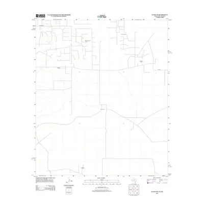
2012 Map of Eunice SE
USGS Topo · Published 2012About this map
The Goins Ranch sits as a central landmark in this high-desert landscape of Lea County, where the economy is clearly defined by the sprawling infrastructure of the Permian Basin's energy sector. Numerous named petroleum zones occupy the terrain, including the Freund Oil Field to the north and the Stateline Oil Field along the southern border. A network of service roads and section-line routes, such as Drinkard Rd and Sw 200, connects these industrial sites across the arid plains. The distribution of features like the Paddock South Oil Field, Nelson Oil Field, and Drinkard Oil Field illustrates a landscape where traditional ranching and modern resource extraction exist in close proximity during the early 21st century.
Find a feature on this map
8 named features on this map. Tap any name to fly to it.
Don’t see what you’re looking for? This feature index may not catch every label — zoom into the map to look around manually.
Map Details
Editions of this 2012 Eunice SE Map
This is the sole edition of this map. No revisions or reprints were ever made.
Other maps of this area

1954 · Hobbs
USGS Topo · 1:250,000

1958 · Hobbs
USGS Topo · 1:250,000

1969 · Jal NE
USGS Topo · 1:24,000

1969 · Eunice
USGS Topo · 1:24,000

1969 · Eunice NE
USGS Topo · 1:24,000

1969 · Eunice SE
USGS Topo · 1:24,000

1969 · Jal NW
USGS Topo · 1:24,000

1969 · Rattlesnake Canyon
USGS Topo · 1:24,000

1971 · Jumbo Hill
USGS Topo · 1:24,000

1971 · Figure Seven Ranch
USGS Topo · 1:24,000