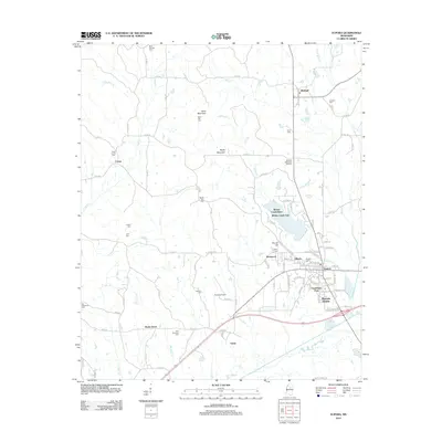
2012 Map of Eupora
USGS Topo · Published 2012About this map
Eupora serves as the primary hub in this central Mississippi landscape, where residential developments like Southland Park and Magnolia Heights cluster near the intersection of regional transit routes. The geography is defined by the Big Black River along the southern border and a series of northward-rising elevations, most notably Sand Mountain and Rocky Mountain. North of the main settlement, Walthall sits among a network of rural roads that connect dispersed communities such as Center and Grady.
Find a feature on this map
108 named features on this map. Tap any name to fly to it.
Don’t see what you’re looking for? This feature index may not catch every label — zoom into the map to look around manually.
Map Details
Editions of this 2012 Eupora Map
This is the sole edition of this map. No revisions or reprints were ever made.
Other maps of this area

1953 · Walthall
USGS Topo · 1:62,500

1953 · West Point
USGS Topo · 1:250,000

1958 · West Point
USGS Topo · 1:250,000

1963 · West Point
USGS Topo · 1:250,000

1966 · Stewart
USGS Topo · 1:24,000

1966 · Tomnolen
USGS Topo · 1:24,000

1968 · Weir
USGS Topo · 1:62,500

1972 · Sapa
USGS Topo · 1:24,000

1972 · Hohenlinden
USGS Topo · 1:24,000
1972 · Reform
USGS Topo · 1:24,000