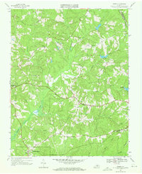
1968 Map of Eureka
USGS Topo · Published 1971About this map
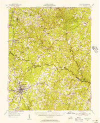
Roanoke Creek and its many tributaries, including Spencer Creek and Ash Camp Creek, carve a rolling landscape through Charlotte County in the late 1960s. This survey, conducted just after photogrammetric mapping in 1967, details a rural Virginia economy defined by small settlements and legacy estates. The Greenfield Plantation remains a prominent landmark north of Eureka, while the county seat at Charlotte Court House serves as a western anchor for the area. Transport and industry are marked by the presence of two major rail lines: the Norfolk and Western traversing the northern section through the Roanoke Hills, and the Southern line running through the town of Drakes Branch in the south. Local spiritual life is well-documented with several rural congregations, such as St Michaels Ch and Mt Harmony Ch, situated alongside numerous family and church cemeteries.
Find a feature on this map
23 named features on this map. Tap any name to fly to it.
Don’t see what you’re looking for? This feature index may not catch every label — zoom into the map to look around manually.
Map Details
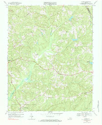
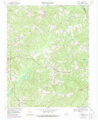
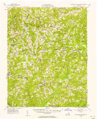
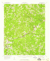
Editions of this 1968 Eureka Map
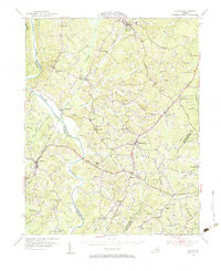
Other maps of this area

1891 · Farmville
USGS Topo · 1:125,000

1892 · Appomattox
USGS Topo · 1:125,000

1893 · Farmville
USGS Topo · 1:125,000

1947 · Roanoke
USGS Topo · 1:250,000

1953 · Greensboro
USGS Topo · 1:250,000

1954 · Greensboro
USGS Topo · 1:250,000
1954 · Clover
USGS Topo · 1:62,500
1955 · Chase City
USGS Topo · 1:62,500
1956 · Charlotte Court House
USGS Topo · 1:62,500
1958 · Keysville
USGS Topo · 1:62,500