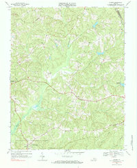
1968 Map of Eureka
USGS Topo · Published 1984About this map
The county seat at Charlotte Court House and the rail junction of Drakes Branch anchor this Southside Virginia landscape in the late 1960s. This survey illustrates a rural Piedmont region defined by the winding course of Roanoke Creek and the Roanoke Hills, where agricultural land and forest are partitioned by a network of local streams including Ash Camp Creek and Spencer Creek.
Find a feature on this map
22 named features on this map. Tap any name to fly to it.
Don’t see what you’re looking for? This feature index may not catch every label — zoom into the map to look around manually.
Map Details
Editions of this 1968 Eureka Map
Other maps of this area

1891 · Farmville
USGS Topo · 1:125,000

1892 · Appomattox
USGS Topo · 1:125,000

1893 · Farmville
USGS Topo · 1:125,000

1947 · Roanoke
USGS Topo · 1:250,000

1953 · Greensboro
USGS Topo · 1:250,000

1954 · Greensboro
USGS Topo · 1:250,000

1954 · Clover
USGS Topo · 1:62,500

1955 · Chase City
USGS Topo · 1:62,500

1956 · Charlotte Court House
USGS Topo · 1:62,500

1958 · Keysville
USGS Topo · 1:62,500