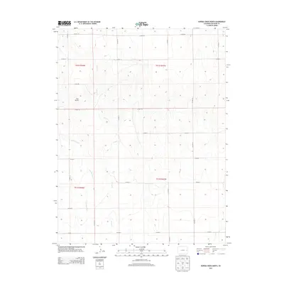
2013 Map of Eureka Creek North
USGS Topo · Published 2013About this map
Twin Buttes rises as a prominent landmark above the High Plains of Cheyenne County in this 2013 topographic study. The landscape is defined by the drainage patterns of Eureka Cr and its tributary, Little Spring Cr, which carve subtle depressions through the central and western portions of the quadrangle. This area reflects a highly organized Public Land Survey System, with the terrain partitioned into townships such as t012s r048w and t012s r047w.
Find a feature on this map
22 named features on this map. Tap any name to fly to it.
Don’t see what you’re looking for? This feature index may not catch every label — zoom into the map to look around manually.
Map Details
Editions of this 2013 Eureka Creek North Map
This is the sole edition of this map. No revisions or reprints were ever made.
Other maps of this area

1891 · Kit Carson
USGS Topo · 1:125,000

1893 · Kit Carson
USGS Topo · 1:125,000

1954 · Limon
USGS Topo · 1:250,000

1954 · Lamar
USGS Topo · 1:250,000

1957 · Limon
USGS Topo · 1:250,000

1958 · Limon
USGS Topo · 1:250,000

1958 · Lamar
USGS Topo · 1:250,000

1969 · Alpine Ranch
USGS Topo · 1:24,000

1979 · Stratton 3 SE
USGS Topo · 1:24,000
1979 · Alpine Ranch SW
USGS Topo · 1:24,000