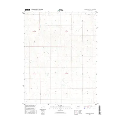
2016 Map of Eureka Creek North
USGS Topo · Published 2016About this map
Twin Buttes rises as a prominent landmark in this portion of Cheyenne County, marking a landscape defined by the drainage basins of the high plains. The intermittent course of Eureka Creek winds south through the center of the map, joined by the smaller tributary of Little Spring Cr to the west. This 2016 survey illustrates the persistent grid of the Public Land Survey System, with township boundaries like t12s r48w and t13s r47w anchoring the rural geography. The network of county roads, including Co Rd AA and Co Rd DD, follows these section lines, revealing the organized settlement pattern typical of the Colorado plains. This map is particularly useful for understanding the modern rural infrastructure and water drainage patterns in a region where topographic relief is subtle yet significant for local navigation and land management.
Find a feature on this map
16 named features on this map. Tap any name to fly to it.
Don’t see what you’re looking for? This feature index may not catch every label — zoom into the map to look around manually.
Map Details
Editions of this 2016 Eureka Creek North Map
This is the sole edition of this map. No revisions or reprints were ever made.
Other maps of this area

1891 · Kit Carson
USGS Topo · 1:125,000

1893 · Kit Carson
USGS Topo · 1:125,000

1954 · Limon
USGS Topo · 1:250,000

1954 · Lamar
USGS Topo · 1:250,000

1957 · Limon
USGS Topo · 1:250,000

1958 · Limon
USGS Topo · 1:250,000

1958 · Lamar
USGS Topo · 1:250,000

1969 · Alpine Ranch
USGS Topo · 1:24,000

1979 · Stratton 3 SE
USGS Topo · 1:24,000
1979 · Alpine Ranch SW
USGS Topo · 1:24,000