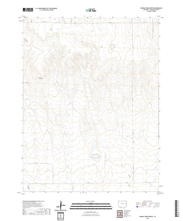
2022 Map of Eureka Creek North
USGS Topo · Published 2022About this map
Twin Buttes serves as a prominent landmark in this section of the High Plains, rising above a landscape defined by intermittent drainage systems in Cheyenne County. This 2022 survey captures the expansive rural character of the region, where the hydrology of Eureka Cr and Little Spring Cr dictates the local topography. The map illustrates a grid of section lines and gravel paths, including Co Rd Dd and Co Rd Aa, which facilitate movement across this sparsely populated ranching and agricultural territory. The lack of concentrated settlements highlights the enduring nature of these large land tracts, where natural features like the ephemeral stream beds remain the primary points of orientation for those navigating the eastern Colorado plains.
Find a feature on this map
16 named features on this map. Tap any name to fly to it.
Don’t see what you’re looking for? This feature index may not catch every label — zoom into the map to look around manually.
Map Details
Editions of this 2022 Eureka Creek North Map
This is the sole edition of this map. No revisions or reprints were ever made.
Other maps of this area

1891 · Kit Carson
USGS Topo · 1:125,000

1893 · Kit Carson
USGS Topo · 1:125,000

1954 · Limon
USGS Topo · 1:250,000

1954 · Lamar
USGS Topo · 1:250,000

1957 · Limon
USGS Topo · 1:250,000

1958 · Limon
USGS Topo · 1:250,000

1958 · Lamar
USGS Topo · 1:250,000

1969 · Alpine Ranch
USGS Topo · 1:24,000

1979 · Stratton 3 SE
USGS Topo · 1:24,000
1979 · Alpine Ranch SW
USGS Topo · 1:24,000