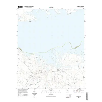
2017 Map of Eutawville
USGS Topo · Published 2017About this map
Lake Marion dominates the northern landscape of this South Carolina region, where the Clarendon and Orangeburg county line follows the submerged channel. The town of Eutawville serves as the primary inland hub, characterized by a grid of local roads like Moncks Corner Rd and Galliard St. Just to the east, the historic vicinity of Eutaw Springs is marked by Battlefield Dr, signaling the area's deep Revolutionary War heritage.
Find a feature on this map
80 named features on this map. Tap any name to fly to it.
Don’t see what you’re looking for? This feature index may not catch every label — zoom into the map to look around manually.
Map Details
Editions of this 2017 Eutawville Map
This is the sole edition of this map. No revisions or reprints were ever made.
Other maps of this area

1920 · Eutawville
USGS Topo · 1:48,000

1920 · Chicora
USGS Topo · 1:48,000

1920 · Manning
USGS Topo · 1:48,000

1921 · Chicora
USGS Topo · 1:62,500

1921 · Manning
USGS Topo · 1:62,500

1921 · Eutawville
USGS Topo · 1:62,500

1943 · Chicora
USGS Topo · 1:62,500

1943 · Eutawville
USGS Topo · 1:62,500

1944 · Manning
USGS Topo · 1:62,500

1954 · Augusta
USGS Topo · 1:250,000