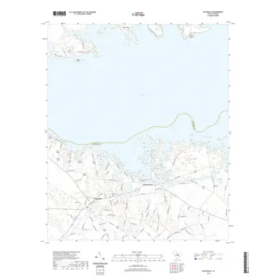
2020 Map of Eutawville
USGS Topo · Published 2020About this map
The town of Eutawville serves as the focal point for this survey of the southern shores of Lake Marion. The landscape is defined by the significant shoreline of the reservoir, where numerous fingers of water create a complex geography of inlets and named landforms like Goat Island and Round Island. The interior contains a mix of residential development and agricultural land, evidenced by Walworth Farms and several local burial sites, including Eutawville Cem, Walworth Cem, and Walnut Grove Cem. Local history is reflected in the street names, with Battlefield Dr and Sinkler Ave located near the established community of Eutaw Springs. The map details the transition from the organized grid of the town center to the winding lakeside developments along Nelson Ferry Rd and Moncks Corner Rd, providing a clear look at modern South Carolina Lowcountry settlement patterns.
Find a feature on this map
85 named features on this map. Tap any name to fly to it.
Don’t see what you’re looking for? This feature index may not catch every label — zoom into the map to look around manually.
Map Details
Editions of this 2020 Eutawville Map
This is the sole edition of this map. No revisions or reprints were ever made.
Other maps of this area

1920 · Eutawville
USGS Topo · 1:48,000

1920 · Chicora
USGS Topo · 1:48,000

1920 · Manning
USGS Topo · 1:48,000

1921 · Chicora
USGS Topo · 1:62,500

1921 · Manning
USGS Topo · 1:62,500

1921 · Eutawville
USGS Topo · 1:62,500

1943 · Chicora
USGS Topo · 1:62,500

1943 · Eutawville
USGS Topo · 1:62,500

1944 · Manning
USGS Topo · 1:62,500

1954 · Augusta
USGS Topo · 1:250,000