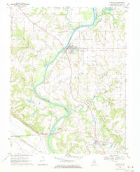
1970 Map of Evansville
USGS Topo · Published 1972About this map
The Kaskaskia River snakes through this Randolph County landscape, serving as a defining geographical feature just before it reaches its confluence with the Mississippi. Near the river's bend sits Evansville, where the concentration of local heritage is evident in the presence of St Boniface Cem, St Peters Cem, and the nearby St Johns Ch. To the south, the village of Ellis Grove stands near the edge of the river valley, while the smaller settlements of Roots, Flinton, and Collins are situated along the lower western reaches of the quadrangle.
Find a feature on this map
33 named features on this map. Tap any name to fly to it.
Don’t see what you’re looking for? This feature index may not catch every label — zoom into the map to look around manually.
Map Details
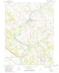
Editions of this 1970 Evansville Map
2 editions found
Other maps of this area

1907 · Weingarten
USGS Topo · 1:62,500

1909 · Weingarten
USGS Topo · 1:62,500

1912 · Baldwin
USGS Topo · 1:62,500

1914 · Baldwin
USGS Topo · 1:62,500

1915 · Renault
USGS Topo · 1:62,500

1915 · Chester
USGS Topo · 1:62,500

1940 · Renault
USGS Topo · 1:62,500

1942 · Baldwin
USGS Topo · 1:62,500

1947 · Chester
USGS Topo · 1:62,500

1949 · Saint Louis
USGS Topo · 1:250,000