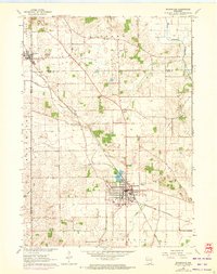
1961 Map of Evansville
USGS Topo · Published 1972About this map
The Chicago and North Western railway corridors define the development of this dairy-farming region where Dane, Green, and Rock Counties meet. The city of Evansville serves as the primary hub, anchored by its proximity to Lake Leota and a well-established Golf Course to its north. Further north, the village of Brooklyn sits along the rail line at the Dane County border, while the smaller settlement of Union and the rural intersection at Butts Corners mark the central agricultural landscape.
Find a feature on this map
29 named features on this map. Tap any name to fly to it.
Don’t see what you’re looking for? This feature index may not catch every label — zoom into the map to look around manually.
Map Details
Editions of this 1961 Evansville Map
3 editions found
Other maps of this area

1889 · Evansville
USGS Topo · 1:62,500

1890 · Stoughton
USGS Topo · 1:62,500

1891 · Janesville
USGS Topo · 1:62,500

1893 · Janesville
USGS Topo · 1:62,500

1893 · Brodhead
USGS Topo · 1:62,500

1894 · Evansville
USGS Topo · 1:62,500

1906 · Evansville
USGS Topo · 1:62,500

1954 · Rockford
USGS Topo · 1:250,000

1955 · Rockford
USGS Topo · 1:250,000

1958 · Rockford
USGS Topo · 1:250,000