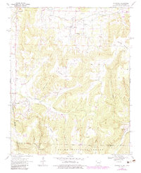
1970 Map of Evansville
USGS Topo · Published 1983About this map
The town of Evansville sits at the western edge of the Ozarks, positioned where Evansville Creek cuts through the highland terrain along the Arkansas and Oklahoma border. This 1970s survey captures a landscape of scattered rural communities and mountain ridges, including Hale Mountain and Skylight Mountain. The area is characterized by a dense network of family-centered landmarks, particularly cemeteries such as Bethlehem Cem and Edmiston Cem, which serve as vital markers for local genealogy.
Find a feature on this map
47 named features on this map. Tap any name to fly to it.
Don’t see what you’re looking for? This feature index may not catch every label — zoom into the map to look around manually.
Map Details
Editions of this 1970 Evansville Map
3 editions found
Other maps of this area

1898 · Winslow #3
USGS Topo · 1:62,500

1898 · Tahlequah
USGS Topo · 1:125,000

1898 · Winslow
USGS Topo · 1:125,000

1901 · Winslow
USGS Topo · 1:125,000

1901 · Tahlequah
USGS Topo · 1:125,000

1905 · Tahlequah
USGS Topo · 1:125,000

1946 · Fort Smith
USGS Topo · 1:250,000

1965 · Fort Smith
USGS Topo · 1:250,000

1967 · Fort Smith
USGS Topo · 1:250,000

1969 · Natural Dam
USGS Topo · 1:24,000