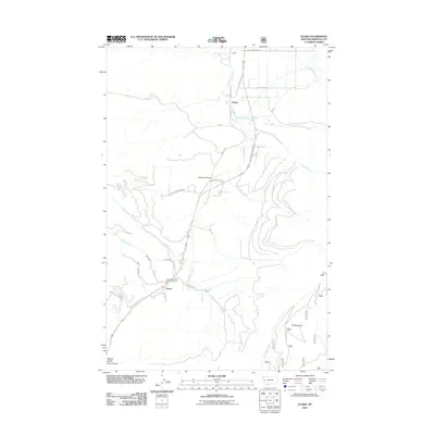
2011 Map of Evaro
USGS Topo · Published 2011About this map
Coriacan Defile serves as a prominent geographic passage through the mountains of Missoula County, directing the flow of travel and water between the Jocko Valley and the Missoula Valley. In this 2011 landscape, the small settlements of Schley and Evaro anchor the rural infrastructure, with the Frenchtown Rural Fire Dist Sta 2 situated near the latter. The terrain is defined by significant drainage systems including Finley Creek, O'Keefe Creek, and McClure Creek, while TV Mountain rises as a dominant high point to the southeast.
Find a feature on this map
28 named features on this map. Tap any name to fly to it.
Don’t see what you’re looking for? This feature index may not catch every label — zoom into the map to look around manually.
Map Details
Editions of this 2011 Evaro Map
This is the sole edition of this map. No revisions or reprints were ever made.
Other maps of this area

1903 · Bonner
USGS Topo · 1:125,000

1912 · Missoula
USGS Topo · 1:125,000

1921 · Elbow Lake
USGS Topo · 1:125,000

1947 · Butte
USGS Topo · 1:250,000

1955 · Choteau
USGS Topo · 1:250,000

1956 · Wallace
USGS Topo · 1:250,000

1956 · Hamilton
USGS Topo · 1:250,000

1957 · Choteau
USGS Topo · 1:250,000

1958 · Butte
USGS Topo · 1:250,000

1958 · Choteau
USGS Topo · 1:250,000