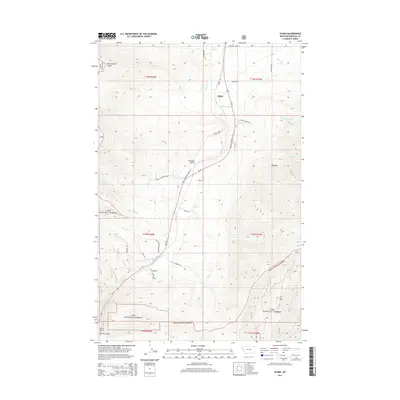
2014 Map of Evaro
USGS Topo · Published 2014About this map
Schley and Evaro anchor this mountain passage in Missoula County, where the landscape is defined by the steep transition between the Reservation Divide and the deep drainage of Marent Gulch. The area's complex topography is highlighted by the Coriacan Defile, a narrow pass used by transportation routes to navigate the high terrain of the Lolo National Forest. Water management and natural hydrology play a central role, with the E Canal and N Canal cutting across the slopes near Finley Creek and McClure Creek.
Find a feature on this map
42 named features on this map. Tap any name to fly to it.
Don’t see what you’re looking for? This feature index may not catch every label — zoom into the map to look around manually.
Map Details
Editions of this 2014 Evaro Map
This is the sole edition of this map. No revisions or reprints were ever made.
Other maps of this area

1903 · Bonner
USGS Topo · 1:125,000

1912 · Missoula
USGS Topo · 1:125,000

1921 · Elbow Lake
USGS Topo · 1:125,000

1947 · Butte
USGS Topo · 1:250,000

1955 · Choteau
USGS Topo · 1:250,000

1956 · Wallace
USGS Topo · 1:250,000

1956 · Hamilton
USGS Topo · 1:250,000

1957 · Choteau
USGS Topo · 1:250,000

1958 · Butte
USGS Topo · 1:250,000

1958 · Choteau
USGS Topo · 1:250,000