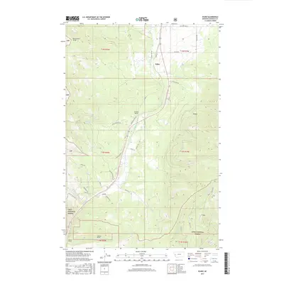
2017 Map of Evaro
USGS Topo · Published 2017About this map
Coriacan Defile serves as the central geographic corridor for this portion of western Montana, where modern roadways and historic pathways converge through the pass between Grizzly Mountain and Beargrass Mountain. The settlements of Schley and Evaro anchor the northern and southern ends of this passage, respectively, surrounded by the extensive reaches of the Lolo National Forest. The landscape is defined by steep drainage basins and creeks, including Finley Cr and Schley Cr, which flow through the rugged terrain of the Reservation Divide. To the south, the iconic Marent Trestle spans across Marent Gulch, a notable engineering landmark in a region characterized by its high-altitude peaks like TV Mtn. This map documents a critical transportation link through the mountains, illustrating how the natural topography has dictated the placement of mountain home lines and forest trails.
Find a feature on this map
46 named features on this map. Tap any name to fly to it.
Don’t see what you’re looking for? This feature index may not catch every label — zoom into the map to look around manually.
Map Details
Editions of this 2017 Evaro Map
This is the sole edition of this map. No revisions or reprints were ever made.
Other maps of this area

1903 · Bonner
USGS Topo · 1:125,000

1912 · Missoula
USGS Topo · 1:125,000

1921 · Elbow Lake
USGS Topo · 1:125,000

1947 · Butte
USGS Topo · 1:250,000

1955 · Choteau
USGS Topo · 1:250,000

1956 · Wallace
USGS Topo · 1:250,000

1956 · Hamilton
USGS Topo · 1:250,000

1957 · Choteau
USGS Topo · 1:250,000

1958 · Butte
USGS Topo · 1:250,000

1958 · Choteau
USGS Topo · 1:250,000