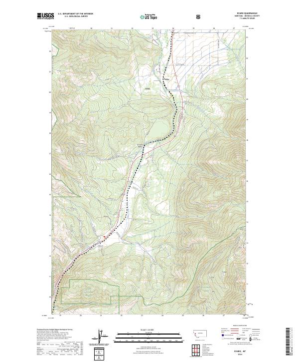
2024 Map of Evaro
USGS Topo · Published 2024About this map
The mountain pass at Coriacan Defile serves as the central corridor for transport and drainage in this portion of Missoula County. The settlement of Evaro sits at the height of this land, where the drainage of Finley Creek begins its descent, while the community of Schley lies to the north near the Fly Canal. This landscape is defined by the steep elevation changes of the Reservation Divide and the southern reaches of the Lolo National Forest, where landmarks like Tv Mtn tower over the valley floor. The map details a network of rural routes named for the local environment and early residents, including Grizzly Mountain Rd and Beargrass Mountain Rd. Waterways such as Mcclure Creek and O'Keefe Creek carve through the timbered terrain, illustrating the hydrologic patterns that dictated early settlement and modern land use.
Find a feature on this map
46 named features on this map. Tap any name to fly to it.
Don’t see what you’re looking for? This feature index may not catch every label — zoom into the map to look around manually.
Map Details
Editions of this 2024 Evaro Map
This is the sole edition of this map. No revisions or reprints were ever made.
Other maps of this area

1903 · Bonner
USGS Topo · 1:125,000

1912 · Missoula
USGS Topo · 1:125,000

1921 · Elbow Lake
USGS Topo · 1:125,000

1947 · Butte
USGS Topo · 1:250,000

1955 · Choteau
USGS Topo · 1:250,000

1956 · Wallace
USGS Topo · 1:250,000

1956 · Hamilton
USGS Topo · 1:250,000

1957 · Choteau
USGS Topo · 1:250,000

1958 · Butte
USGS Topo · 1:250,000

1958 · Choteau
USGS Topo · 1:250,000