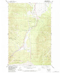
1984 Map of Evaro
USGS Topo · Published 1984About this map
Flathead Indian Reservation boundaries meet the Lolo National Forest here, creating a landscape defined by sharp elevation changes and vital water management systems. The high peaks of the Rattlesnake Range are represented by TV Mountain and La Valle Point, which overlook the complex drainage of Finley Creek and O'Keefe Creek. This mid-1980s data highlights the critical infrastructure required for mountain living and transport, including the Mc Clure Flume and a network of canals and pipelines that parallel the rugged terrain.
Find a feature on this map
26 named features on this map. Tap any name to fly to it.
Don’t see what you’re looking for? This feature index may not catch every label — zoom into the map to look around manually.
Map Details
Editions of this 1984 Evaro Map
This is the sole edition of this map. No revisions or reprints were ever made.
Other maps of this area

1903 · Bonner
USGS Topo · 1:125,000

1912 · Missoula
USGS Topo · 1:125,000

1921 · Elbow Lake
USGS Topo · 1:125,000

1947 · Butte
USGS Topo · 1:250,000

1955 · Choteau
USGS Topo · 1:250,000

1956 · Wallace
USGS Topo · 1:250,000

1956 · Hamilton
USGS Topo · 1:250,000

1957 · Choteau
USGS Topo · 1:250,000

1958 · Butte
USGS Topo · 1:250,000

1958 · Choteau
USGS Topo · 1:250,000