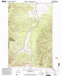
1999 Map of Evaro
USGS Topo · Published 2003About this map
The Flathead Indian Reservation boundary defines much of the human and natural geography of this Montana landscape as it appeared at the close of the twentieth century. Centered around the small community of Evaro, the terrain is marked by the distinct intersection of tribal lands and the Lolo National Forest. This era shows a transition in land use, where older extractive features like Gravel Pits and a Water Tank sit near modern infrastructure, including a high-elevation Communication Site and a major Pipeline. Water management is prominent throughout the quadrangle, evidenced by a network of drainage systems such as Marent Gulch, O'Keefe Creek, and Finley Creek. The map records the path of Highway 93 as it climbs through the mountain passes, following the natural corridors used for travel and utility long before modern pavement.
Find a feature on this map
27 named features on this map. Tap any name to fly to it.
Don’t see what you’re looking for? This feature index may not catch every label — zoom into the map to look around manually.
Map Details
Editions of this 1999 Evaro Map
This is the sole edition of this map. No revisions or reprints were ever made.
Other maps of this area

1903 · Bonner
USGS Topo · 1:125,000

1912 · Missoula
USGS Topo · 1:125,000

1921 · Elbow Lake
USGS Topo · 1:125,000

1947 · Butte
USGS Topo · 1:250,000

1955 · Choteau
USGS Topo · 1:250,000

1956 · Wallace
USGS Topo · 1:250,000

1956 · Hamilton
USGS Topo · 1:250,000

1957 · Choteau
USGS Topo · 1:250,000

1958 · Butte
USGS Topo · 1:250,000

1958 · Choteau
USGS Topo · 1:250,000