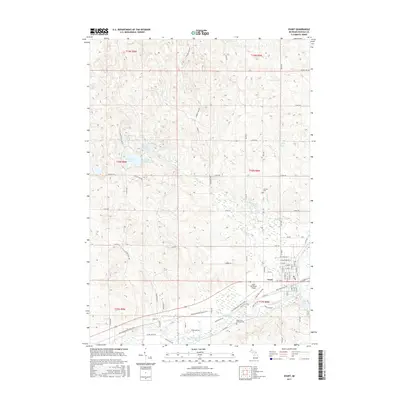
2017 Map of Evart
USGS Topo · Published 2017About this map
The Muskegon River meanders through the southern portion of this Osceola County landscape, providing the natural anchor for the city of Evart. This area serves as a significant recreational and transit corridor, highlighted by the Pere Marquette State Trail and the Pere Marquette TRL following the former railroad path south of the river. The northern half of the quadrangle is characterized by numerous small glacial water bodies, including Horsehead Lake, Sunrise Lake, and Strawberry Lake. Genealogical interest is found at the German Cem and Holy Cross Catholic Cem, while the Evart Municipal Airport and the local Po represent the civic development of the community. The map also detail local industry and infrastructure near S Industrial Park Dr, reflecting the town's role as a regional hub for the surrounding township lands.
Find a feature on this map
81 named features on this map. Tap any name to fly to it.
Don’t see what you’re looking for? This feature index may not catch every label — zoom into the map to look around manually.
Map Details
Editions of this 2017 Evart Map
This is the sole edition of this map. No revisions or reprints were ever made.
Other maps of this area

1954 · Traverse City
USGS Topo · 1:250,000

1954 · Midland
USGS Topo · 1:250,000

1957 · Cadillac South
USGS Topo · 1:62,500

1957 · Marion
USGS Topo · 1:62,500

1958 · Traverse City
USGS Topo · 1:250,000

1958 · Midland
USGS Topo · 1:250,000

1959 · Midland
USGS Topo · 1:250,000

1959 · Lake
USGS Topo · 1:62,500

1959 · Evart
USGS Topo · 1:62,500

1966 · Midland
USGS Topo · 1:250,000