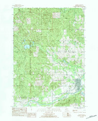
1983 Map of Evart
USGS Topo · Published 1984About this map
The Muskegon River and North River converge south of Evart, defining a landscape where river-driven industry and recreation meet the vast wooded tracts of the Pere Marquette State Forest. In the early 1980s, this area of Osceola County was bisected by the Chesapeake and Ohio railroad, which served the community near Sacred Heart Ch and the Municipal Airport.
Find a feature on this map
45 named features on this map. Tap any name to fly to it.
Don’t see what you’re looking for? This feature index may not catch every label — zoom into the map to look around manually.
Map Details
Editions of this 1983 Evart Map
This is the sole edition of this map. No revisions or reprints were ever made.
Other maps of this area

1954 · Traverse City
USGS Topo · 1:250,000

1954 · Midland
USGS Topo · 1:250,000

1957 · Cadillac South
USGS Topo · 1:62,500

1957 · Marion
USGS Topo · 1:62,500

1958 · Traverse City
USGS Topo · 1:250,000

1958 · Midland
USGS Topo · 1:250,000

1959 · Midland
USGS Topo · 1:250,000

1959 · Lake
USGS Topo · 1:62,500

1959 · Evart
USGS Topo · 1:62,500

1966 · Midland
USGS Topo · 1:250,000