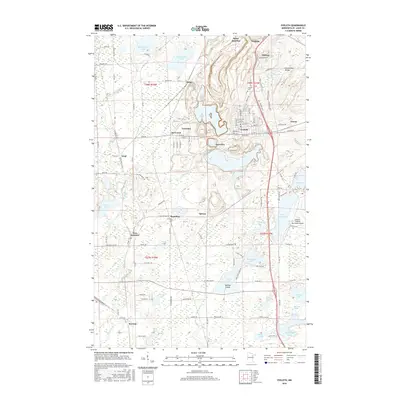
2016 Map of Eveleth
USGS Topo · Published 2016About this map
The Laurentian Divide cuts across the northeastern corner of this landscape, marking the high ground where water flows toward either the Hudson Bay or the Great Lakes. This portion of the Mesabi Range is characterized by a dense concentration of mining-era settlements, including Eveleth, Leonidas, and Genoa, many of which were established to house the workers of the local iron industry. The survey details the intricate relationship between industrial geography and the natural terrain, showing how residential clusters like Snowden and De Forest are bordered by expansive water bodies such as Ely Lake and Saint Marys Lake. From the southern edge near Keenan to the northern limits at Rainy Junction, the map captures a modern view of Saint Louis County’s complex infrastructure, where the Eveleth-Virginia Municipal Airport and a network of county roads like Old Mesabe Rd and Iron Junction Rd weave together the historic mining communities.
Find a feature on this map
105 named features on this map. Tap any name to fly to it.
Don’t see what you’re looking for? This feature index may not catch every label — zoom into the map to look around manually.
Map Details
Editions of this 2016 Eveleth Map
This is the sole edition of this map. No revisions or reprints were ever made.
Other maps of this area

1950 · Mc Kinley
USGS Topo · 1:24,000

1951 · Mc Kinley
USGS Topo · 1:24,000

1951 · Gilbert
USGS Topo · 1:24,000

1951 · Eveleth
USGS Topo · 1:24,000

1951 · Virginia
USGS Topo · 1:24,000

1951 · Kinney
USGS Topo · 1:24,000

1951 · Kirk
USGS Topo · 1:24,000

1951 · Central Lakes
USGS Topo · 1:24,000

1951 · Zim
USGS Topo · 1:24,000

1951 · Casco
USGS Topo · 1:24,000