2022 Map of Eveleth
USGS Topo · Published 2022About this map
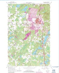
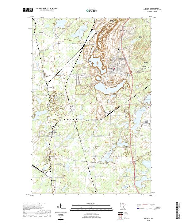
The Mesabi Range defines the industrial and geographic character of this St. Louis County landscape, where the iron-rich terrain is bisected by the Laurentian Divide. This topographic study highlights the cluster of Iron Range communities that grew around the mining operations, including Virginia, Eveleth, and Mountain Iron. The map illustrates a complex network of transportation and infrastructure, from the Eveleth-Virginia Municipal Airport to numerous rail-related settlements like Rainy Junction, Iron Junction, and Keenan. Beyond the urban centers, the map documents a transition to a lake-strewn wilderness, featuring notable bodies of water such as Manganika Lake, Mashkenode Lake, and the extensive Long Lake system. Educational and civic landmarks like the Mesabi Range Community and Technical College and Eveleth Cem are clearly marked, providing essential reference points for local history.
Find a feature on this map
90 named features on this map. Tap any name to fly to it.
Don’t see what you’re looking for? This feature index may not catch every label — zoom into the map to look around manually.
Map Details
Editions of this 2022 Eveleth Map
This is the sole edition of this map. No revisions or reprints were ever made.