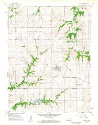
1961 Map of Everest
USGS Topo · Published 1962About this map
Everest sits at the heart of this northeast Kansas landscape, serving as a primary junction where the Missouri Pacific and Chicago Rock Island and Pacific railroads intersect. The town's grid is surrounded by a network of rural townships including Mission, Washington, and Grasshopper, reflecting the organized agricultural development of the early 1960s. To the south, the village of Kennekuk and the nearby Kennekuk Cem mark an area of historical settlement along the Clear Creek drainage.
Find a feature on this map
20 named features on this map. Tap any name to fly to it.
Don’t see what you’re looking for? This feature index may not catch every label — zoom into the map to look around manually.
Map Details
Editions of this 1961 Everest Map
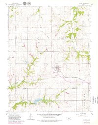
2 editions found
Other maps of this area

1885 · Atchison
USGS Topo · 1:125,000

1888 · Atchison
USGS Topo · 1:125,000

1888 · Hiawatha
USGS Topo · 1:125,000

1893 · Atchison
USGS Topo · 1:125,000

1894 · Hiawatha
USGS Topo · 1:125,000

1950 · Kansas City
USGS Topo · 1:250,000

1954 · Kansas City
USGS Topo · 1:250,000

1956 · Kansas City
USGS Topo · 1:250,000
1959 · Highland
USGS Topo · 1:24,000

1960 · Kansas City
USGS Topo · 1:250,000