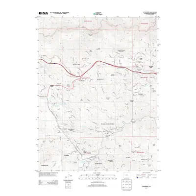
2013 Map of Evergreen
USGS Topo · Published 2013About this map
Evergreen and the surrounding Front Range communities are shown here during a period of sustained residential development and recreational use. The map details the complex geography of the Bear Creek and Clear Creek drainages, where winding mountain roads like Squaw Pass Rd and Evergreen Pkwy connect established settlements such as Kittredge and Troutdale. Local history is preserved through the locations of the Rockland Cem and Evergreen Cem, alongside the Church of the Transfiguration near the town center.
Find a feature on this map
81 named features on this map. Tap any name to fly to it.
Don’t see what you’re looking for? This feature index may not catch every label — zoom into the map to look around manually.
Map Details
Editions of this 2013 Evergreen Map
This is the sole edition of this map. No revisions or reprints were ever made.
Other maps of this area

1899 · West Denver
USGS Topo · 1:125,000

1906 · Blackhawk
USGS Topo · 1:62,500

1938 · Morrison
USGS Topo · 1:24,000

1939 · Golden
USGS Topo · 1:24,000

1942 · Morrison
USGS Topo · 1:31,680

1942 · Golden
USGS Topo · 1:31,680

1942 · Black Hawk
USGS Topo · 1:24,000

1942 · Ralston Buttes
USGS Topo · 1:24,000

1944 · Black Hawk
USGS Topo · 1:31,680
1944 · Ralston Buttes
USGS Topo · 1:31,680