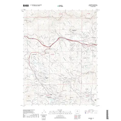
2019 Map of Evergreen
USGS Topo · Published 2019About this map
Evergreen and the surrounding Front Range communities are meticulously documented in this 2019 survey, illustrating the complex residential expansion into the mountainous terrain of Jefferson County. The map details a network of named gulches and peaks, including Independence Mtn and Elephant Butte, which frame the valley floor where Evergreen Lake remains a central geographic feature. Local history is anchored by the Church of the Transfiguration and burial sites like Evergreen Cem and Rockland Cem.
Find a feature on this map
76 named features on this map. Tap any name to fly to it.
Don’t see what you’re looking for? This feature index may not catch every label — zoom into the map to look around manually.
Map Details
Editions of this 2019 Evergreen Map
This is the sole edition of this map. No revisions or reprints were ever made.
Other maps of this area

1899 · West Denver
USGS Topo · 1:125,000

1906 · Blackhawk
USGS Topo · 1:62,500

1938 · Morrison
USGS Topo · 1:24,000

1939 · Golden
USGS Topo · 1:24,000

1942 · Morrison
USGS Topo · 1:31,680

1942 · Golden
USGS Topo · 1:31,680

1942 · Black Hawk
USGS Topo · 1:24,000

1942 · Ralston Buttes
USGS Topo · 1:24,000

1944 · Black Hawk
USGS Topo · 1:31,680
1944 · Ralston Buttes
USGS Topo · 1:31,680