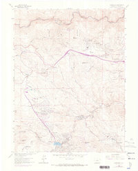
1971 Map of Evergreen
USGS Topo · Published 1973About this map
The mountain community of Evergreen serves as the focal point of this Jefferson County survey, which documents the expansion of residential and recreational enclaves into the foothills in the early 1970s. The landscape is defined by the convergence of Bear Creek and Wilmot Cr at Evergreen Lake, where the Hiwan Country Club and Mountain Parks Golf Course signal the area's growth as a suburban retreat. The map tracks the winding course of the Genesee Park Boundary and various mountain parks like O'Fallon Park and Dedisse Park.
Find a feature on this map
64 named features on this map. Tap any name to fly to it.
Don’t see what you’re looking for? This feature index may not catch every label — zoom into the map to look around manually.
Map Details
Editions of this 1971 Evergreen Map
This is the sole edition of this map. No revisions or reprints were ever made.
Other maps of this area

1899 · West Denver
USGS Topo · 1:125,000

1906 · Blackhawk
USGS Topo · 1:62,500

1938 · Morrison
USGS Topo · 1:24,000

1939 · Golden
USGS Topo · 1:24,000

1942 · Morrison
USGS Topo · 1:31,680

1942 · Golden
USGS Topo · 1:31,680

1942 · Black Hawk
USGS Topo · 1:24,000

1942 · Ralston Buttes
USGS Topo · 1:24,000

1944 · Black Hawk
USGS Topo · 1:31,680
1944 · Ralston Buttes
USGS Topo · 1:31,680