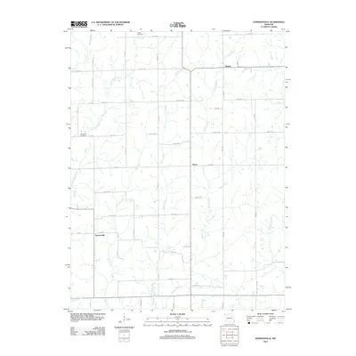
2012 Map of Eversonville
USGS Topo · Published 2012About this map
Eversonville and the surrounding rural landscape of Linn County are defined by a network of north-south flowing waterways that carve through the agricultural tablelands. The settlement patterns at Shafter and Hecla follow the section lines and the state highway corridor, illustrating the structured grid of the Midwestern prairie. Small family-linked landmarks such as the Smith Cemetery and Van Horne Cemetery are preserved amidst the fields, providing vital touchpoints for genealogical research. The drainage system is particularly intricate here, with Parson Creek and Smoky Creek meandering through the central portion of the quadrangle, while Little Muddy Creek and Coon Creek drain the western reaches. This 2012 survey captures a quiet, established farming region where local roads like Arbor Rd and Cotton Rd still mirror the 19th-century land surveys, connecting scattered farmsteads and rural junctions.
Find a feature on this map
53 named features on this map. Tap any name to fly to it.
Don’t see what you’re looking for? This feature index may not catch every label — zoom into the map to look around manually.
Map Details
Editions of this 2012 Eversonville Map
This is the sole edition of this map. No revisions or reprints were ever made.
Other maps of this area

1924 · Chula
USGS Topo · 1:62,500

1946 · Brookfield
USGS Topo · 1:62,500

1946 · Galt
USGS Topo · 1:62,500

1947 · Chula
USGS Topo · 1:62,500

1948 · Brookfield
USGS Topo · 1:62,500

1949 · Galt
USGS Topo · 1:62,500

1953 · Moberly
USGS Topo · 1:250,000

1954 · Centerville
USGS Topo · 1:250,000

1954 · Moberly
USGS Topo · 1:250,000

1957 · Moberly
USGS Topo · 1:250,000