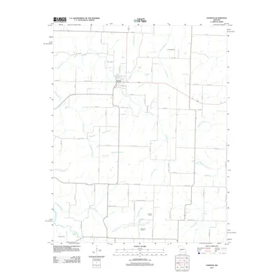
2011 Map of Everton
USGS Topo · Published 2011About this map
Everton serves as the central hub of this agricultural and creek-riven landscape in the early 21st century. The town is situated at the intersection of several local routes, including Springfield St and Road B, which connect the town to the surrounding countryside. Evidence of local industry and community infrastructure appears through features such as the East Limekiln north of town and the Hopewell School to the southeast.
Find a feature on this map
69 named features on this map. Tap any name to fly to it.
Don’t see what you’re looking for? This feature index may not catch every label — zoom into the map to look around manually.
Map Details
Editions of this 2011 Everton Map
This is the sole edition of this map. No revisions or reprints were ever made.
Other maps of this area

1886 · Greenfield
USGS Topo · 1:125,000

1888 · Greenfield
USGS Topo · 1:125,000

1919 · Halltown
USGS Topo · 1:62,500

1921 · Stotts City
USGS Topo · 1:62,500

1954 · Springfield
USGS Topo · 1:250,000

1955 · Dadeville
USGS Topo · 1:24,000

1956 · Ash Grove
USGS Topo · 1:24,000
1956 · Walnut Grove
USGS Topo · 1:24,000

1956 · Greenfield
USGS Topo · 1:24,000
1956 · South Greenfield
USGS Topo · 1:24,000