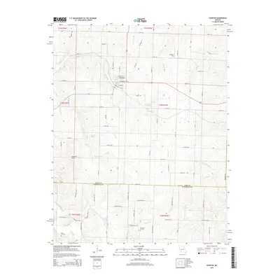
2015 Map of Everton
USGS Topo · Published 2015About this map
Everton serves as the central hub of this Dade County landscape, where the local street grid intersects with regional routes like E School St and E Springfield St. The terrain is defined by a dense network of seasonal and perennial waterways that have shaped local land use, including Sinking Cr and the waters of Turnback Creek. Geologists and local historians may find interest in the numerous springs and hollows that dot the area, such as Ray Spring and the curiously named Stillhouse Hollow.
Find a feature on this map
73 named features on this map. Tap any name to fly to it.
Don’t see what you’re looking for? This feature index may not catch every label — zoom into the map to look around manually.
Map Details
Editions of this 2015 Everton Map
This is the sole edition of this map. No revisions or reprints were ever made.
Other maps of this area

1886 · Greenfield
USGS Topo · 1:125,000

1888 · Greenfield
USGS Topo · 1:125,000

1919 · Halltown
USGS Topo · 1:62,500

1921 · Stotts City
USGS Topo · 1:62,500

1954 · Springfield
USGS Topo · 1:250,000

1955 · Dadeville
USGS Topo · 1:24,000

1956 · Ash Grove
USGS Topo · 1:24,000
1956 · Walnut Grove
USGS Topo · 1:24,000

1956 · Greenfield
USGS Topo · 1:24,000
1956 · South Greenfield
USGS Topo · 1:24,000