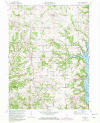
1972 Map of Everton
USGS Topo · Published 1982About this map
The Treaty Line cuts a significant historical diagonal through this landscape, marking the intersection of Jackson, Jennings, and Harmony townships. This 1970s-era survey documents the rural character of southeastern Indiana, where small settlements like Everton and Alquina serve as local hubs for the surrounding farm country. In the southeast, the creation of Brookville Lake has dramatically altered the topography along the E Fk Whitewater River, flooding the lowlands and creating a new recreational shoreline featuring a Campground.
Find a feature on this map
33 named features on this map. Tap any name to fly to it.
Don’t see what you’re looking for? This feature index may not catch every label — zoom into the map to look around manually.
Map Details
Editions of this 1972 Everton Map
4 editions found
Other maps of this area

1915 · College Corner
USGS Topo · 1:48,000

1915 · Harrison
USGS Topo · 1:48,000

1918 · College Corner
USGS Topo · 1:62,500

1948 · Fairfield
USGS Topo · 1:24,000

1953 · Cincinnati
USGS Topo · 1:250,000

1955 · Mount Carmel
USGS Topo · 1:24,000

1956 · Everton
USGS Topo · 1:24,000

1956 · Alpine
USGS Topo · 1:24,000

1956 · Brownsville
USGS Topo · 1:24,000

1956 · Metamora
USGS Topo · 1:24,000