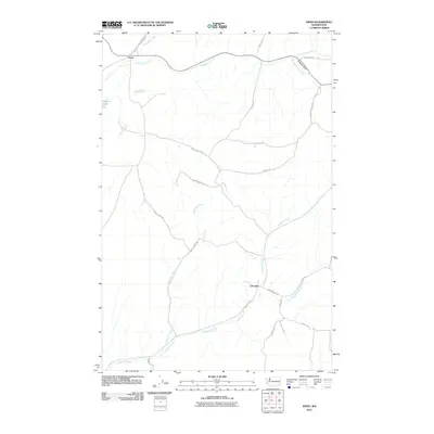
2011 Map of Ewan
USGS Topo · Published 2011About this map
Ewan and Lancaster anchor this agricultural landscape in Whitman County, where the Palouse terrain is defined by an intricate network of seasonal and perennial waterways. The northern reach is dominated by the course of Cottonwood Creek and the smaller Kamiache Creek, while the southern portion of the quadrangle is drained by Downing Creek and its tributary, the East Fork Downing Creek. The rural character of the area is underscored by a grid of named roads that follow the contours of the land, including Rock Lake Rd and Lancaster Rd. Stevens Lake provides a notable point of interest in the western section. The map reveals the persistence of small-scale settlement patterns in eastern Washington, where historical farming communities remain connected by a web of local routes like Harry Pierce Rd and Bonnington Rd.
Find a feature on this map
25 named features on this map. Tap any name to fly to it.
Don’t see what you’re looking for? This feature index may not catch every label — zoom into the map to look around manually.
Map Details
Editions of this 2011 Ewan Map
This is the sole edition of this map. No revisions or reprints were ever made.
Other maps of this area

1950 · La Crosse
USGS Topo · 1:62,500

1950 · Endicott
USGS Topo · 1:62,500

1952 · La Crosse
USGS Topo · 1:62,500

1955 · Pullman
USGS Topo · 1:250,000

1955 · Spokane
USGS Topo · 1:250,000

1958 · Spokane
USGS Topo · 1:250,000

1958 · Pullman
USGS Topo · 1:250,000

1964 · Lamont NE
USGS Topo · 1:24,000

1964 · St. John
USGS Topo · 1:24,000

1964 · Rock Lake
USGS Topo · 1:24,000