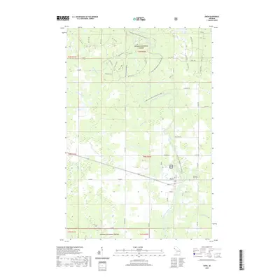
2019 Map of Ewen
USGS Topo · Published 2019About this map
The Ewen settlement serves as the central hub of this northern Michigan landscape, situated just north of the South Branch Ontonagon River. Surrounded by the protected lands of the Ottawa National Forest, the region is defined by an intricate network of waterways including Mulligan Creek, Maple Leaf Creek, and Shoemaker Creek, which feed into the main river branch. The terrain reflects a mix of forest management and local homesteading, with many roads and landmarks bearing family names such as Trudgeon Road, Sironen Road, and Ojanniemi. For genealogists and local historians, the map provides precise locations for the Evergreen-Ewen Cemetery and the N Cemetery, as well as the path of Old M 28 as it bypasses the town's core near Elm Street and Maple Street.
Find a feature on this map
69 named features on this map. Tap any name to fly to it.
Don’t see what you’re looking for? This feature index may not catch every label — zoom into the map to look around manually.
Map Details
Editions of this 2019 Ewen Map
This is the sole edition of this map. No revisions or reprints were ever made.
Other maps of this area

1949 · Matchwood NW
USGS Topo · 1:24,000

1949 · Rockland
USGS Topo · 1:62,500

1951 · Rockland
USGS Topo · 1:62,500

1952 · Watersmeet
USGS Topo · 1:62,500

1952 · Thayer
USGS Topo · 1:62,500

1956 · Matchwood NW
USGS Topo · 1:24,000

1956 · Matchwood
USGS Topo · 1:62,500

1958 · Iron River
USGS Topo · 1:250,000

1960 · Iron River
USGS Topo · 1:250,000

1961 · Iron River
USGS Topo · 1:250,000