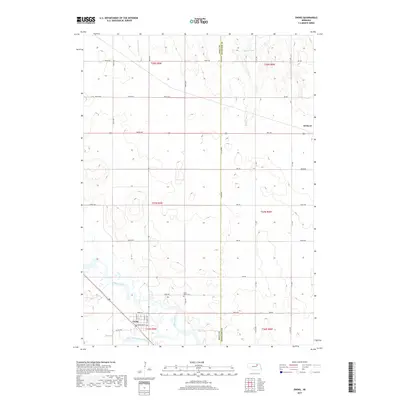
2017 Map of Ewing
USGS Topo · Published 2017About this map
Ewing sits at the confluence of the Elkhorn River and its southern fork, serving as a focal point for the agricultural landscape along the Holt and Antelope county line. The village grid is clearly defined by streets such as N Main St and E Nebraska St, while the surrounding prairie is partitioned by a rigorous network of section roads like York Rd. Notable for local history and genealogy, the Saint Peter Cem is situated just north of the river, east of the main town site. The northern reaches of the quadrangle transition into the drainages of Big Springs Cr and S Br Verdigre Cr, illustrating the subtle hydrology of the Nebraska plains. The presence of the Cowboy Trl crossing the river valley highlights the transformation of former rail corridors into modern recreational paths.
Find a feature on this map
38 named features on this map. Tap any name to fly to it.
Don’t see what you’re looking for? This feature index may not catch every label — zoom into the map to look around manually.
Map Details
Editions of this 2017 Ewing Map
This is the sole edition of this map. No revisions or reprints were ever made.
Other maps of this area

1955 · O'Neill
USGS Topo · 1:250,000

1958 · Page
USGS Topo · 1:24,000

1959 · O'Neill
USGS Topo · 1:250,000

1963 · Ewing SW
USGS Topo · 1:24,000

1963 · Venus
USGS Topo · 1:24,000

1963 · Orchard
USGS Topo · 1:24,000

1963 · Ewing
USGS Topo · 1:24,000

1963 · Deloit NE
USGS Topo · 1:24,000
1963 · Clearwater
USGS Topo · 1:24,000

1963 · Deloit NW
USGS Topo · 1:24,000