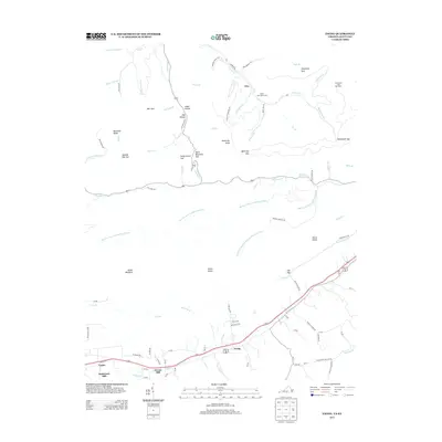
2013 Map of Ewing
USGS Topo · Published 2013About this map
Ewing and its surrounding mountain gaps define this portion of Lee County near the state line. The landscape is split between the agricultural valley floor and the high ridges of the Cumberland Mountains, where industrial remnants like the Black Star Coal Camp and Alva sit along Puckett Cr. Early river-based commerce is evident at Kesterson Mill and Cowan Mill along the southern waterways, while the rugged northern heights are marked by the Chunklick Look Out Tower and several strategic crossings including Black Mountain Gap and Spanish Oak Gap. The drainage patterns of the Martins Fork Cumberland River and its various forks highlight the complex hydrology of the region. Notable terrain features such as White Rocks and Bailes Meadows suggest a landscape used for both lookout points and upland grazing, providing a clear picture of the area's physical and cultural geography.
Find a feature on this map
78 named features on this map. Tap any name to fly to it.
Don’t see what you’re looking for? This feature index may not catch every label — zoom into the map to look around manually.
Map Details
Editions of this 2013 Ewing Map
This is the sole edition of this map. No revisions or reprints were ever made.
Other maps of this area

1886 · Cumberland Gap
USGS Topo · 1:125,000

1887 · Jonesville
USGS Topo · 1:125,000

1888 · Cumberland Gap
USGS Topo · 1:125,000

1891 · Cumberland Gap
USGS Topo · 1:125,000

1891 · Jonesville
USGS Topo · 1:125,000

1903 · Harlan
USGS Topo · 1:48,000

1903 · Pineville
USGS Topo · 1:48,000

1903 · Middlesboro
USGS Topo · 1:48,000

1916 · Harlan
USGS Topo · 1:48,000

1919 · Harlan
USGS Topo · 1:62,500