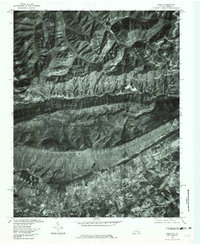
1976 Map of Ewing
USGS Topo · Published 1981About this map
Cumberland Mountain dominates this mid-1970s orthophotoquad, serving as a massive natural barrier that defines the settlement patterns of Lee County, Virginia. To the south, the village of Ewing and the community of Caylor sit along the fertile valley of Indian Creek, where the land is carved into distinct agricultural plots. This contrasts sharply with the heavily forested and deeply dissected terrain to the north. In the rugged upper portion of the map, the headwaters of Martins Fork Cumberland River and Brownies Creek wind through steep hollows. The settlement of Alva is positioned near Puckett Creek, connected to the southern valley through the notable passage at Ely Gap. The imagery reveals the stark transition between the organized valley farms and the shadowed, timbered heights of Butterfly Knob.
Find a feature on this map
11 named features on this map. Tap any name to fly to it.
Don’t see what you’re looking for? This feature index may not catch every label — zoom into the map to look around manually.
Map Details
Editions of this 1976 Ewing Map
This is the sole edition of this map. No revisions or reprints were ever made.
Other maps of this area

1886 · Cumberland Gap
USGS Topo · 1:125,000

1887 · Jonesville
USGS Topo · 1:125,000

1888 · Cumberland Gap
USGS Topo · 1:125,000

1891 · Cumberland Gap
USGS Topo · 1:125,000

1891 · Jonesville
USGS Topo · 1:125,000

1903 · Harlan
USGS Topo · 1:48,000

1903 · Pineville
USGS Topo · 1:48,000

1903 · Middlesboro
USGS Topo · 1:48,000

1916 · Harlan
USGS Topo · 1:48,000

1919 · Harlan
USGS Topo · 1:62,500