
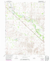
1963 Map of Ewing SW
USGS Topo · Published 1964About this map
The Elkhorn River meanders across this Holt County landscape, defining the hydrology of a region marked by extensive wetland systems and sandy terrain. Surveyed in the early 1960s, the map reveals the critical transportation corridor of the Chicago and North Western railroad, which cuts a sharp diagonal through the prairie. The small settlement of Stafford sits as a lonely outpost along these tracks, serving as a focal point for the surrounding rural townships of Verdigris, Inman, Golden, Mcclure, and Ewing.
Find a feature on this map
10 named features on this map. Tap any name to fly to it.
Don’t see what you’re looking for? This feature index may not catch every label — zoom into the map to look around manually.
Map Details
Editions of this 1963 Ewing SW Map
2 editions found
Other maps of this area

1955 · O'Neill
USGS Topo · 1:250,000

1958 · Inman
USGS Topo · 1:24,000

1958 · Page
USGS Topo · 1:24,000

1959 · O'Neill
USGS Topo · 1:250,000

1963 · Venus
USGS Topo · 1:24,000

1963 · Ewing
USGS Topo · 1:24,000

1963 · Deloit NE
USGS Topo · 1:24,000

1963 · Deloit NW
USGS Topo · 1:24,000

1964 · O'Neill SE
USGS Topo · 1:24,000

1969 · O'Neill
USGS Topo · 1:250,000