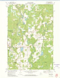
1972 Map of Exeland
USGS Topo · Published 1975About this map
The Chippewa River meanders through this landscape, marking the convergence of the Brunet River and the Couderay River within the township of Radisson. The village of Exeland serves as the primary settlement, positioned along the Soo Line Railroad where it intersects with local roads like Swede Road. This 1972 survey captures a rural Wisconsin community centered around its local institutions and the water. To the west of the rail line, the Weirgor Springs State Wildlife Area and Weirgor Springs State Public Hunting Grounds define the conservation-minded character of the terrain.
Find a feature on this map
43 named features on this map. Tap any name to fly to it.
Don’t see what you’re looking for? This feature index may not catch every label — zoom into the map to look around manually.
Map Details
Editions of this 1972 Exeland Map
This is the sole edition of this map. No revisions or reprints were ever made.
Other maps of this area

1944 · Exeland
USGS Topo · 1:48,000

1944 · Couderay
USGS Topo · 1:48,000

1944 · Radisson
USGS Topo · 1:48,000

1945 · Meteor
USGS Topo · 1:48,000

1947 · Exeland
USGS Topo · 1:48,000

1948 · Couderay
USGS Topo · 1:48,000

1949 · Radisson
USGS Topo · 1:48,000

1949 · Meteor
USGS Topo · 1:48,000

1953 · Rice Lake
USGS Topo · 1:250,000

1959 · Rice Lake
USGS Topo · 1:250,000