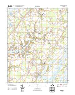
2013 Map of Exmore
USGS Topo · Published 2013About this map
Exmore sits as the central hub of this Eastern Shore landscape, where the Lankford Hwy corridor connects a string of historic villages and coastal settlements. The map illustrates a distinctive maritime economy along the Chesapeake Bay side and the Atlantic-facing marshes, evidenced by landing points like Miles Wharf and Shields Wharf on Occohannock Creek. To the east, Willis Wharf provides access to the Machipongo River and Upshur Bay, highlighting the peninsula's narrow geography where land and water are tightly integrated.
Find a feature on this map
125 named features on this map. Tap any name to fly to it.
Don’t see what you’re looking for? This feature index may not catch every label — zoom into the map to look around manually.
Map Details
Editions of this 2013 Exmore Map
This is the sole edition of this map. No revisions or reprints were ever made.
Other maps of this area

1931 · Accomac
USGS Topo · 1:48,000

1935 · Accomac
USGS Topo · 1:62,500

1941 · Broadwater
USGS Topo · 1:62,500

1942 · Nandua Creek
USGS Topo · 1:24,000

1942 · Little Machipongo Inlet
USGS Topo · 1:24,000

1942 · Nassawadox
USGS Topo · 1:24,000

1943 · Nassawadox
USGS Topo · 1:31,680

1943 · Jamesville
USGS Topo · 1:31,680

1943 · Pungoteague
USGS Topo · 1:31,680

1943 · Franktown
USGS Topo · 1:31,680