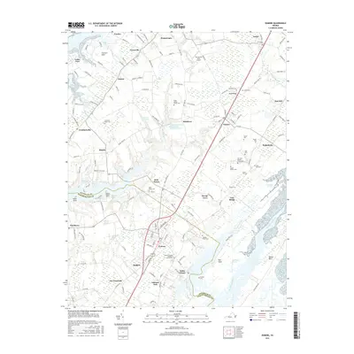
2016 Map of Exmore
USGS Topo · Published 2016About this map
Exmore serves as a central hub on Virginia's Eastern Shore, positioned along the transport corridor that bisects the peninsula between the Chesapeake Bay to the west and the Machipongo River to the east. This landscape is a patchwork of small agricultural settlements and maritime centers, where deep-water access at Willis Wharf contrasts with the interior farmsteads of Belle Haven and Painter. The area is notably dense with family burial grounds and small churchyards, such as the Ames - Hyslop Family Cem and the New Zion Baptist Church Cem, which offer significant breadcrumbs for genealogical research.
Find a feature on this map
149 named features on this map. Tap any name to fly to it.
Don’t see what you’re looking for? This feature index may not catch every label — zoom into the map to look around manually.
Map Details
Editions of this 2016 Exmore Map
This is the sole edition of this map. No revisions or reprints were ever made.
Other maps of this area

1931 · Accomac
USGS Topo · 1:48,000

1935 · Accomac
USGS Topo · 1:62,500

1941 · Broadwater
USGS Topo · 1:62,500

1942 · Nandua Creek
USGS Topo · 1:24,000

1942 · Little Machipongo Inlet
USGS Topo · 1:24,000

1942 · Nassawadox
USGS Topo · 1:24,000

1943 · Nassawadox
USGS Topo · 1:31,680

1943 · Jamesville
USGS Topo · 1:31,680

1943 · Pungoteague
USGS Topo · 1:31,680

1943 · Franktown
USGS Topo · 1:31,680