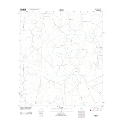
2013 Map of Ezzell
USGS Topo · Published 2013About this map
The Lavaca River meanders through this portion of Lavaca County, defining a landscape of riparian corridors and rural crossroads. The small settlements of Koerth and Ezzell serve as local anchors, connected by a network of county roads such as FM-531 and FM-2616 that trace the higher ground between numerous tributaries. This area is heavily defined by its drainage systems, including Waterhole Cr, Yellow Bank Cr, and Clarks Cr, which feed into the primary river channel. A distinctive geographic feature known as Tiger Bend marks a sharp oxbow in the river's course, while Brown Bridge provides a documented crossing point in the eastern portion of the quadrangle. The map illustrates a contemporary rural Texas environment where historical land patterns remain visible through the names of local branches like Foley Br and Kent Br, which likely reflect early family homesteads and long-standing agricultural holdings in the region.
Find a feature on this map
59 named features on this map. Tap any name to fly to it.
Don’t see what you’re looking for? This feature index may not catch every label — zoom into the map to look around manually.
Map Details
Editions of this 2013 Ezzell Map
This is the sole edition of this map. No revisions or reprints were ever made.
Other maps of this area

1953 · Seguin
USGS Topo · 1:250,000

1958 · Seguin
USGS Topo · 1:250,000

1962 · Terryville
USGS Topo · 1:24,000

1962 · Sublime
USGS Topo · 1:24,000

1962 · Hallettsville SE
USGS Topo · 1:24,000

1962 · Hallettsville
USGS Topo · 1:24,000

1963 · Sweet Home
USGS Topo · 1:24,000

1964 · Morales
USGS Topo · 1:24,000

1964 · Ezzell
USGS Topo · 1:24,000

1965 · Wied
USGS Topo · 1:24,000