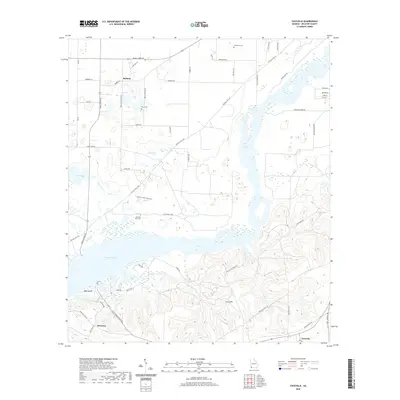
2020 Map of Faceville
USGS Topo · Published 2020About this map
Bethany and Recovery anchor a landscape defined by the expansive waters of Lake Seminole in this modern-era study of Decatur County. The map details a rural geography where community life centers around established institutions like Bethany Church and Morning Star Church, alongside family-named sites such as Breedlove Cem and Mock Cem. The terrain shifts from the level agricultural lands and scattered wetlands surrounding Silver Lake to the more varied elevations of Curry Hill and the complex shoreline of Bass Island. Local transit is traced through a dense network of country roads, including Ten Mile Still Rd and Faceville Landing Rd, which connect these small settlements to the river systems. The inclusion of Peter Pond and the branching reaches of Butlers Cr and Sanborn Cr highlights the intricate hydrography that has shaped the area's development and recreational character.
Find a feature on this map
63 named features on this map. Tap any name to fly to it.
Don’t see what you’re looking for? This feature index may not catch every label — zoom into the map to look around manually.
Map Details
Editions of this 2020 Faceville Map
This is the sole edition of this map. No revisions or reprints were ever made.
Other maps of this area

1954 · Desser
USGS Topo · 1:24,000

1954 · Tallahassee
USGS Topo · 1:250,000

1955 · Reynoldsville
USGS Topo · 1:24,000

1955 · Chattahoochee
USGS Topo · 1:24,000

1955 · Bainbridge
USGS Topo · 1:62,500

1955 · Mt Pleasant
USGS Topo · 1:24,000

1956 · Dogtown
USGS Topo · 1:24,000

1959 · Tallahassee
USGS Topo · 1:250,000

1960 · Tallahassee
USGS Topo · 1:250,000
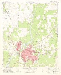
1974 · Bainbridge
USGS Topo · 1:24,000